


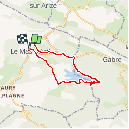

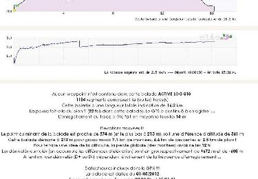
16,2 km | 23 km-effort


Gebruiker


Gratisgps-wandelapplicatie
 SityTrail
IGN / Geografische instituten
SityTrail World
De wereld gaat voor u open
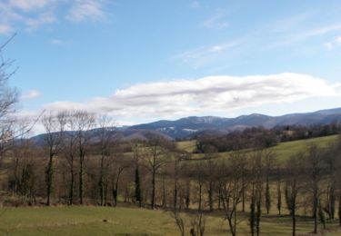
Tocht Stappen van 13,3 km beschikbaar op Occitanië, Ariège, Le Mas-d'Azil. Deze tocht wordt voorgesteld door pidjam.
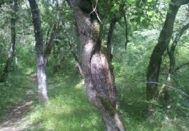
Au départ et à l'arrivée un peu de route sous les pieds, mais le reste est dans les bois, autour du lac, très joli (quelques passages boueux à prévoir).


Stappen

Stappen
Stappen
Stappen
Mountainbike
Stappen

Mountainbike

Paard

Paard